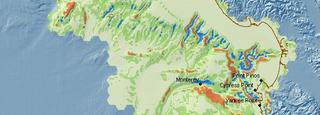
 Well that's really the question right? It was for me at least, I've spent the last 10 years putting off an advanced degree mostly because it was the path of least resistance. I've been lucky enough to be really working as a geographer - GIS mostly. Now that I'm back in the academic mix I keep thinking "what was I waiting for?" Biogeography is extremely relevant for me right now. Managing all the GIS support for TNC in CA calls on the fundamentals quite a bit.
For the better part of the last two years I've been the GIS analyst supporting a number of marine planning projects. These are done at a the ecoregional scale and for California that means the California Current. So biogeograpy is concerned with the distribution of species through space and time....this notion is the crux of representative conservation planning. While for some taxa there are good GIS data sets available, for most there are not, this particullarly true for marine. In cases where there are not data available they can be modeled. This is where biogeography comes in. The better I can understand the relationships taxa have to their spatial environment, the better the GIS models to use a surrogates for conservation.
No comments:
Post a Comment